
Map Grand Prairie ZIP Service
Postal information for Grand Prairie is useful when it is kept in its proper role. A 2021 USPS service-area table supports a working list of five ZIPs connected to Grand Prairie: 75050, 75051, 75052, 75053, and 75054. That is a provisional, USPS-linked list, not a promise that every current delivery address or postal status has been confirmed. Run a live USPS address check before using the list for mail, a physical-address question, or an official form.
The table avoids invented neighborhood boundaries. The reviewed source links the ZIPs to local postal service points, but it does not establish an exact current delivery or PO-box classification for every code. In particular, 75053 needs a live check.
| ZIP | Areas Covered | Post Office | Notes |
|---|---|---|---|
| 75050 | Grand Prairie postal context in the working list | Fountain | Linked to Carrier Parkway in the reviewed USPS service-area table; confirm the live address. |
| 75051 | Grand Prairie postal context in the working list | Carrier Parkway | Local USPS location is at 802 S Carrier Pkwy; validate the individual address live. |
| 75052 | Grand Prairie postal context in the working list | Westchester | Linked to Westchester in the reviewed USPS service-area table; confirm the live address. |
| 75053 | Grand Prairie postal context in the working list | Carrier Parkway | Delivery and PO-box status were not confirmed in the reviewed official pages. |
| 75054 | Grand Prairie postal context in the working list | Westchester | Linked to Westchester in the reviewed USPS service-area table; confirm the live address. |
Historical USPS references also label these Grand Prairie ZIPs, but historical postal files are not a current boundary map. The useful result is a starting code to verify, not a claim about every address within a broad area.
Grand Prairie ZIP Postal Points
The reviewed USPS material identifies three local service points. The location at 802 S Carrier Pkwy, Grand Prairie, TX 75051-9998 is available through the official USPS location record. USPS material also lists a Westchester office at 765 W Westchester Pkwy, Grand Prairie, TX 75052-9998 and a Fountain office at 505 Fountain Pkwy, Grand Prairie, TX 75050-9998. These locations provide postal context, not municipal-boundary or parcel confirmation.
Check the USPS Carrier Parkway location when confirming the local office context for an address.
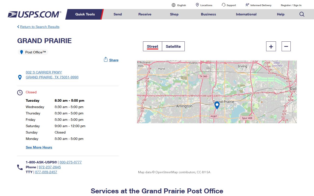
The location record anchors the local office reference, while a live postal lookup remains necessary for a particular delivery address.
Search a Grand Prairie ZIP
A ZIP is best used to organize an address verification, not to make a list of people. Start with the full address and current postal result, then inspect the city GIS ZIP and city-limit layers. Once the parcel and county are known, the appropriate CAD can supply the tax-account route. The city has no universal resident roster, and a parcel record or postal label should not be treated as a statement of who is physically present.
- Check the full mailing address through a live USPS tool. Save the normalized postal city, state, and ZIP with the date checked.
- Open the Grand Prairie GIS Information service and compare the ZIP layer with city limits, ETJ, and county layers.
- Use the parcel location to identify the applicable CAD: Dallas, Tarrant, Ellis, or Johnson County.
- Record the CAD account and GIS parcel identifier if a land-record question remains. Keep the ZIP as a lookup key, not a personal attribute.
- For a street-level parcel trail after the ZIP is narrowed, use the Grand Prairie street directory route.
Texas voter tools have official registration-status and polling-place functions when their required identifiers are supplied. They are not a ZIP-wide resident search, and protected address fields remain protected.
Note: A ZIP narrows postal geography, while the parcel and county determine which land-record custodian applies.
Grand Prairie ZIP Result Fields
When a ZIP search leads to an address, keep the result focused on geography and source quality. The recommended Grand Prairie record is a compact set of fields that lets a reader reproduce a parcel or city-boundary check without copying personal details. Do not turn a postal result into a profile.
| Field | Why it belongs in a Grand Prairie ZIP result |
|---|---|
| Normalized address | Gives the postal form used for the live confirmation. |
| Postal city, state, and ZIP | Records the USPS delivery context without equating it with a legal boundary. |
| Municipality and county | Separates city and county jurisdiction from the postal label. |
| CAD account and GIS parcel ID | Connects an address to the correct tax-account and map route when available. |
| City-limit or ETJ flag | Shows why a nearby address can have a Grand Prairie postal label yet a different municipal context. |
| Confidence and source date | Preserves which official source supplied the result and when it was checked. |
These fields reflect the research recommendation for ZIP-page results. They also make it easier to explain a mismatch to an agency without claiming more than the source shows.
Grand Prairie ZIP GIS Layer
The city’s GIS Information MapServer includes ZIP Codes alongside city limits, ETJ, counties, floodplain, schools, libraries, parks, districts, churches, gas wells, and a 200-foot flood buffer. That mix is a local map feature, not resident data. It helps explain why a postal result and a municipal result can both be accurate while describing different geographies.
Use the ZIP layer with city limits and counties switched on. If the address is near a boundary, compare the parcel geometry rather than relying on the nearest familiar postal name.
Review the Grand Prairie GIS ZIP and boundary layers before assigning a county from a postal code.
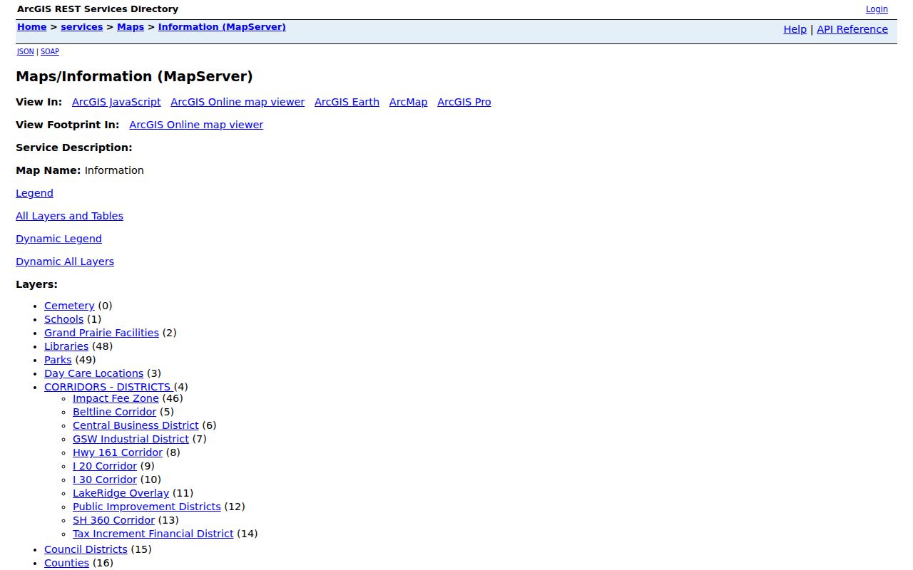
The GIS service places the ZIP layer beside city and county boundaries, which makes the difference visible without implying that the ZIP is a legal district.
Grand Prairie ZIP County Check
Grand Prairie is a multi-county city. The FY2025 city ACFR identifies Dallas, Tarrant, Ellis, and Johnson counties, while a city neighborhood page identifies Dallas, Tarrant, and Ellis. That discrepancy is not a shortcut to resolve. It is a reason to confirm the actual parcel before selecting an appraisal district, county clerk, court, or local vital-record office.
For a Dallas parcel, start with DCAD’s address search. Tarrant has its appraisal district and CAID map, Ellis has a CAD map and parcel-data route, and Johnson has CAD and GIS entry points. The ZIP itself does not choose among them. A city address may also have a postal city/ZIP context that does not match the municipal or county line.
Note: The city’s spread across county systems is a local record-routing issue, not a claim that one ZIP equals one county.
Check Grand Prairie ZIP 75053
The 2021 USPS service-area table connects 75053 with the Carrier Parkway service point and supports its inclusion in the working five-ZIP list. The reviewed sources did not confirm whether 75053 has a current delivery or PO-box-only role. Do not label it one way or the other from the historical references or the service-area table alone.
Use the current USPS address tool for the exact address and date in question. If a city or CAD result differs from a mailing label, retain both results and check the Grand Prairie GIS parcel and boundary layers. That is more reliable than trying to reconcile the difference from a ZIP label alone.
Open the USPS service site for live address confirmation rather than relying on this provisional reference list.
The USPS context image supports the need for a fresh lookup, especially where the reviewed materials did not establish present delivery status.
Grand Prairie ZIP Postal Terms
Postal terms describe how mail is sorted and delivered. They do not define a city boundary or a land-record jurisdiction. The differences below help keep a Grand Prairie postal result clear when an address has both a city map record and a postal label.
- ZIP Code
- A USPS delivery geography used to sort mail. It is not a legal city limit.
- ZIP+4
- An added four-digit segment that narrows a delivery point or delivery grouping within a five-digit ZIP.
- PO-box ZIP
- A postal code used for post-office-box service. Its exact current role must be confirmed by USPS for the address at issue.
- Carrier route
- A USPS delivery grouping used to organize mail service, not a municipal district or parcel boundary.
Grand Prairie ZIP City Limits
A ZIP Code is a USPS delivery geography, not a legal city limit. A Grand Prairie mailing label can reach beyond the municipal boundary, and an address inside the city can use a ZIP associated with a neighboring postal area. Census ZIP Code Tabulation Areas are generalized statistical geography, so they should not replace USPS validation or the city parcel map for an individual address.
The city’s physical-address rule makes the division clear. Grand Prairie assigns physical addresses only after a legal plat is filed, while USPS handles mailing-address questions. For address assignment or a physical-address change, use the city 911 Addressing process; planning lists phone, email, and City Hall contact routes. For postal delivery, use USPS. For a parcel or county question, use GIS and the matching CAD.
Use a ZIP carefully. A Grand Prairie ZIP can help organize a postal or map check, but it does not identify a household. Keep personal details out of ZIP results and confirm the original custodian when a jurisdiction decision matters.