
Grand Prairie Neighbors by Parcel
A block question has several official sources, each with a narrow purpose. Start with physical geography, then use the applicable county record system for an instrument or appraisal field. A parcel owner field can differ from a mailing address, and neither proves who occupies the site. The voluntary association layer can explain a subdivision or common area, but it is not a household directory. This sequence keeps a search for Grand Prairie neighbors focused on the public record that actually answers the question.
| Source | What It Shows About a Block | Access |
|---|---|---|
| Grand Prairie parcel layer | Parcel geometry, address fields, parcel ID, and adjacent lots | City GIS query service |
| County appraisal district | County-specific account, situs, legal-description, and displayed owner fields | Applicable CAD portal or map |
| County clerk index | Recorded deeds, plats, easements, liens, and related instruments | Online index, image, in-person, or mail copy route |
| City planning and plats | Subdivision boundaries, streets, common areas, and easements | City planning materials and recorded plat trail |
| HOA map and directory | Voluntary association and subdivision context | City map or supplied public association information |
For Grand Prairie neighbors, distinguish a current tax-account view from a recorded deed and from actual occupancy. Each source answers a different question, and an absent name does not establish that no one is associated with a block.
Grand Prairie Neighbors GIS Flow
Use the city parcel and street services to connect an address to its public geography. The parcel service exposes a GIS link or 17-character parcel ID, street number, street name, street type, city, city-state-ZIP, address, coordinates, and polygon geometry. It supports a parcel-level question without requiring a person search. The broader streets service adds address points, buildings, city limits, counties, parks, and other features that help place the block.
- Enter the street number, name, and type in the city GIS service and identify the address or parcel polygon.
- Inspect immediately adjoining parcel geometry and save each parcel ID, street address, and county context.
- Open the correct county CAD and keep its account number, situs address, legal description, and displayed ownership fields as separate facts.
- When a deed, plat, or easement is needed, take the legal description or instrument clues to the matching county clerk index.
The Grand Prairie parcel feature layer is shown below. It is most useful for locating the parcels around an address before asking a county record question.
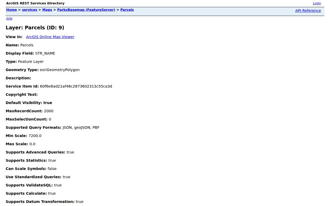
The parcel screen provides geography and fields, not proof of a household identity. For a full named-street record chain, use the Grand Prairie By Street directory after the correct county is known.
Grand Prairie Neighbors County CAD
Grand Prairie's county boundary is a real records issue. City sources name Dallas, Tarrant, and Ellis counties, while the FY2025 ACFR also names Johnson County. A Grand Prairie mailing address, city label, or ZIP Code cannot reliably choose the county clerk or appraisal district. Confirm the address with city GIS and then route it to DCAD, Tarrant Appraisal District, Ellis CAD, or Johnson CAD.
The field set varies by county. DCAD supports street, owner, account, business, and map searches. Its street search uses a number, direction, street name, optional building or suite, city, and account type. Tarrant's parcel schema includes account, displayed owner, owner mailing fields, situs address, legal-description fields, school, and exemption. Those Tarrant labels are a county-specific example, not a promise that Ellis or Johnson will display the same fields.
After CAD, use the county clerk. Dallas official records can be researched by name or instrument number, and Tarrant's official index offers real-property searching with dates, images, and index-only or OCR choices. Dallas and Tarrant also document online, counter, and mail-copy alternatives. Check the current Ellis or Johnson clerk instructions before relying on a route that was not fully captured.
Grand Prairie Neighbors Plats Easements
Plats are often the clearest record for a block question about lot lines, shared space, streets, or easements. Grand Prairie's planning materials describe preliminary, amending, replat, final, and minor plats. A plat can show boundaries, street layout, common areas, and easements, but it does not identify a current household. Compare the plat name and filing date with the CAD legal description and the county clerk image before drawing a conclusion.
City 911 Addressing also matters when an address seems to change. The city assigns an address after a parcel is legally platted and filed with the county, generally using one address per parcel. It can change a physical address when sequencing or access is confusing. An address-history question may therefore require the recorded plat and current parcel, not merely an old mailing label.
Note: Capture the instrument number and recording date from the county clerk index before relying on a plat or easement image.
Grand Prairie Neighbor HOA Context
The city's HOA map and directory can connect a block to a voluntarily supplied association name. That is useful for subdivision and planning research. It does not prove that every parcel is governed by an association, that a listed officer lives nearby, or that a listed contact is a resident. Use the association name to locate plats, planning material, and publicly supplied association information, not to assemble personal contacts.
The Grand Prairie HOA map appears below. It adds an association overlay to the parcel and county records trail.
Representative association names in the city material include Lake Parks East and West, Westchester on the Creek, and Property Owners of Lake Ridge. Use a map result as voluntary community context rather than a claim about a particular property.
Public association listing
Check the city HOA directory or map for the association name, public website, or public contact route supplied by the association.
Private city contact
The city form keeps a separate city-contact field that is not public. Do not treat it as a block contact or a neighbor record.
Plat and planning follow-up
Use the association or subdivision name to narrow a public plat, replat, development, or common-area question.
Grand Prairie Neighbors Civic Layers
Some of the best block context is not personal at all. The city Information service includes floodplain, cemetery, school, library, park, church, public-improvement district, corridor, city-limit, ETJ, ZIP Code, and 200-foot flood-buffer layers. These can explain why a block is governed, planned, or served differently from the next one. They are useful for civic curiosity and property context without turning a map into a person list.
For example, city limits and ETJ layers can reveal a boundary overlap that changes the appropriate county or city route. A floodplain or corridor layer can add context to a plat review. The Grand Prairie Information map service should be used with the address and parcel layers, not as evidence of a resident's identity.
Grand Prairie Neighbors Source Comparison
Official maps and rolls are narrower than commercial neighbor-search tools, and that is a strength. The official route identifies the agency, the record type, the date, and the access limit. Commercial categories can combine copied or stale information without showing which county or document supports it. When a block question concerns a deed, boundary, or association, return to the official record rather than treating a compiled result as the final answer.
| Official map or roll | Shows a defined parcel, account, recorded instrument, or civic layer with a named public custodian and a source-specific limit. |
|---|---|
| Commercial neighbor tool | May combine information from multiple sources, but can be stale, incomplete, or detached from the parcel county and record date. |
| Best follow-up | Confirm the county, review the CAD or clerk record, and retain only the fields needed for the stated block question. |
Grand Prairie Neighbors Over Time
When an adjacent-parcel question becomes historical, switch from current GIS to dated sources. The UT Briscoe telephone-directory sequence covers Grand Prairie from 1918 through 2005 with gaps, and a Library of Congress criss-cross inventory has a Grand Prairie 1966 entry. Telephone and criss-cross directories are snapshots, not continuous proof. Pair a dated address result with tax lists, deeds, newspapers, or a map.
The 1929 Grand Prairie and Dalworth Sanborn set has nine sheets. It can show buildings and block uses before modern parcel lines, but it cannot prove who lived in a structure. That limitation is useful: start with the exact street or parcel, note the map year, and then seek a dated directory or county record that fits the same period.
Account for collection gaps before reaching a negative conclusion. ROOTS identifies a 1938 through 1952 gap in its Grand Prairie Texan holdings. For that span, compare nearby years and try Arlington or Dallas newspapers, tax lists, and the telephone directories. A missing historic reference can reflect the surviving collection rather than a break in a block's history.
Grand Prairie Neighbors Privacy Limits
Public access has boundaries. Texas voter guidance treats residence addresses, Texas driver license or ID details, and protected categories differently from permitted status fields. Recent vital records have separate access limits, and a municipal court form accepting a driver's-license number does not make that number a publishable result. A city map, a county account, and a voluntary association listing should each be used only for the limited question they answer.
For an error, ask the original custodian about its correction process or an applicable confidentiality form. A field may be suppressed under a statute or program without the underlying record disappearing. Do not copy private association contacts, full dates of birth, protected addresses, or personal identity numbers into notes about Grand Prairie neighbors.
Lawful use. Use public block records for a lawful, limited purpose such as understanding a parcel, association, or local history. Do not use them to stalk, harass, threaten, impersonate, or contact a private person.