
Trace a Grand Prairie Street Address
An address-based search can establish parcel context, a tax-account owner field, and recorded land documents. It cannot establish a complete household. In Grand Prairie, the first task is to identify the physical parcel and its county, because the city reaches into Dallas, Tarrant, Ellis, and Johnson counties. The city parcel layer is a good starting point, then the matching county appraisal district and county clerk provide the record trail. Treat the property address, owner field, mailing address, and a directory entry as separate facts rather than as interchangeable proof that a particular person is present.
Use the street directory in a narrow sequence. A range can help when only a block is known, but it can return many parcels. Save the parcel identifier, county, and source date for the one address that matters before moving to a recorded document or historical source.
- Enter the street number, name, and type in the city parcel and address layer. Check the parcel, city limits, ZIP context, county, adjacent parcels, and buildings.
- Open the appraisal district for that county. Record the CAD account, situs address, legal description, displayed owner field, and mailing address separately.
- For a lawful status or polling-place question, use the Texas voter portal with its required identifiers. It is not a bulk street roster and protected address information must stay protected.
- Search the applicable county official-record index by grantor, grantee, instrument number, date, or legal description. Read the instrument image before describing a transfer.
- For a past address question, compare a criss-cross or telephone directory with tax lists, maps, and deeds. Each is a dated snapshot.
Note: A recorded deed identifies an instrument, while an appraisal account reflects a tax record and neither alone proves present occupancy.
Grand Prairie Addressing Before Search
The city assigns a physical address after a parcel has been legally platted and filed with the county. One address per parcel is the normal arrangement; suites belong to multi-unit structures. A valid address is also required for permits. When a sequence is confusing, difficult to locate, or does not match a driveway, the city can change the physical property address. Mailing-address changes, by contrast, belong with USPS.
The Grand Prairie 911 Addressing office requests an approved, recorded digital plat for assignment or verification. Building and suite requests also require site or floor plans. Planning lists service through City Hall, by phone at 972-237-8255, and by email at msespinoza@gptx.org. Those are the right channels for an address-assignment question, not an appraisal search.
Grand Prairie Street GIS Fields
The city’s Streets Base Map service combines address points, apartment buildings, parcel lots, buildings, streets, counties, parks, city limits, and other map layers. Its parcel feature layer identifies a record with a 17-character GIS link and includes street number, street name, street-type code, city, city/state/ZIP, address, coordinates, and polygon geometry. That makes the Grand Prairie street directory useful for locating the right parcel without turning a map into a people list.
Use the city field values as a location check. The parcel layer can include city values beyond Grand Prairie, so a name in a service response should not substitute for checking city limits and county context.
View the Grand Prairie GIS streets and address service before selecting a county route.
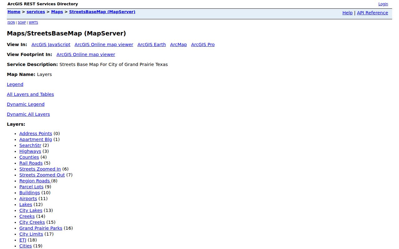
The map-service view shows why street, boundary, and parcel context should be checked together before a county record search.
Search Grand Prairie Streets in DCAD
For a Grand Prairie parcel in Dallas County, the Dallas Central Appraisal District address form separates the number, direction, street name, building, suite, city, and account type. The street-name box has unusual rules: enter at least two characters, omit the street type, and do not put spaces in that field. An exact search uses one number; a range uses From and To. If a one-letter street is needed, DCAD suggests the form X%.
| DCAD field | Input | Grand Prairie street-search note |
|---|---|---|
| Number | Required text or number | Use one number for an exact address, or From and To for a range. Do not add suite letters. |
| Direction | Optional dropdown | Select the street direction when it is part of the address. |
| Street Name | At least two characters | Omit the street type, use % as a wildcard, and use X% for a one-letter street. |
| Building and Suite | Optional text | Add only when the location is a multi-unit structure. |
| City and Account Type | Optional selector | Choose the city when offered and select residential, commercial, or BPP as needed. |
| Search | Button | Returns blue property-address links in the DCAD results. |
DCAD’s sample appraisal card separates owner, mailing address, property address, and legal description. That distinction matters in a street directory search. A mailing city may differ from the situs address, and an appraisal card is not a recorded deed.
Grand Prairie Streets Cross Counties
Grand Prairie’s FY2025 ACFR identifies Dallas, Tarrant, Ellis, and Johnson counties. The city neighborhood page names Dallas, Tarrant, and Ellis. Keep the difference as a verification issue, not a reason to choose a county from the city name. Start with the parcel and GIS context, then use the matching CAD and clerk. A ZIP label is postal information, not a recorder assignment.
Dallas parcels lead to DCAD and the Dallas official-record index. Tarrant parcels can begin at the Tarrant Appraisal District or its county appraisal/GIS viewer. Ellis has a county CAD map and parcel-data route, while Johnson offers a CAD search entry point and GIS application. The reviewed research did not capture exact live clerk field labels for Ellis or Johnson, so verify the county clerk path before relying on a deed search there.
Note: County selection comes from the address and parcel, not from a Grand Prairie mailing label or a street name by itself.
Grand Prairie Street Plat Context
A plat is the recorded map that lays out a subdivision or parcel arrangement. The city’s Subdivision Plats and Abstracts page identifies preliminary, amending, replat, final, and minor plats. They can clarify boundaries, easements, streets, and common areas. City interactive maps also expose subdivision layers. Ownership belongs with the applicable county appraisal district, so a plat should be read as place context rather than as an ownership list.
- Parcel
- A mapped unit of land used to connect an address, a CAD account, and a legal description.
- Situs address
- The physical property address shown for a parcel. It can differ from the owner’s mailing address.
- Plat
- A filed subdivision or land map that can show streets, lots, easements, and common areas.
- Criss-cross directory
- A historical directory arranged by address, useful for comparing dated household entries along a street.
Grand Prairie Street Activity Records
City activity can add a date or project context to a parcel, but it is not a resident directory. Grand Prairie Customer Self-Service allows an account holder to apply for permits, plans, and licenses; request inspections; view development cases; search existing permits, plans, inspections, code cases, service requests, and licenses; estimate fees; and pay invoices. Login requirements and record-specific confidentiality still apply. A permit or code entry should be treated as a city-action record, not as proof that a named person lives at the location.
Start at the city’s permit and Customer Self-Service entry point for the account-based route. The Code Compliance status page directs the public to CSS for violations, inspection results, and previous or pending actions, with recent cases available through service-request access. Grand Prairie does not maintain a vacant or distressed-property registration, so do not infer a person or occupancy from a code case.
Grand Prairie Street Record Routes
Different address-keyed sources answer different parts of a street question. The city GIS establishes location. A CAD account provides the current tax-account view. County official records preserve instruments, and city planning material adds plat context. The Texas voter portal can confirm a lawful status or polling-place query when its identity fields are available, but it should never be treated as a current-residence or block list.
| Address record | Grand Prairie keeper | What it can establish | Access channel |
|---|---|---|---|
| City parcel and address layer | Grand Prairie GIS | Parcel geography, address fields, county and civic overlays | Online map service |
| Appraisal account | Applicable county CAD | Account, situs, legal description, displayed owner and mailing fields | Online CAD or map entry |
| Recorded instruments | Applicable county clerk | Deeds, liens, releases, affidavits, plats, and instrument dates | Online index, copy request, mail, or counter route |
| Address assignment | Grand Prairie Planning | Physical addressing and approved-plat requirements | Phone, email, City Hall, and planning materials |
| Voter status | Texas Secretary of State | Registration-status and polling-place utility within legal limits | My Voter Portal with required identifiers |
For a street-by-street question, preserve the source trail: agency, record type, address or instrument key, date, and what the result does not prove. That avoids treating a single name match as an identity finding.
Grand Prairie Deeds by Address
Once the county is known, move from the CAD legal description or displayed owner to the county clerk’s official-record index. A grantor is the party transferring an interest; a grantee is the party receiving it. Tarrant’s official search accepts grantor, grantee, subdivision, document type, or document number, along with recorded-date filters, an image option, and index-only or index-plus-OCR searching. It covers real-property records, but a search result is a lead until the image is reviewed.
The Tarrant official-record search shows the available index controls. Tarrant says deeds, deeds of trust, liens, releases, affidavits, and plats are scanned, indexed, and published, generally five to seven business days after recording. The county does not perform title or lien searches. Read each instrument and capture its number and date instead of assuming a word hit creates a full chain of title.
Open the Tarrant PublicSearch index to compare the available real-property filters.
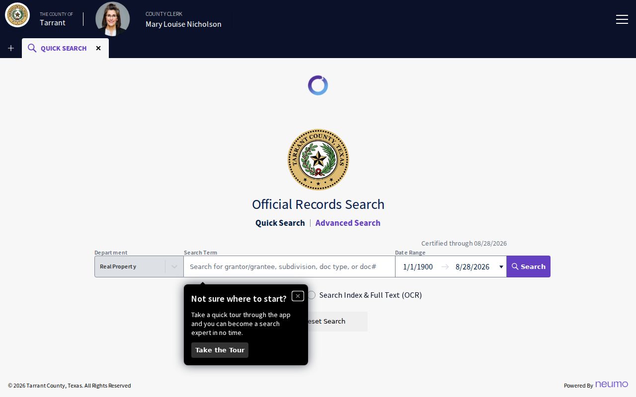
For a Tarrant parcel, the image and recorded-date controls help narrow a street-related instrument search without claiming that a result proves occupancy.
Dallas provides online search and e-Certify where a digitally viewable record is available. If it is not available, use the paper request or an in-person route. The Dallas form asks for such items as recorded name, grantor or grantee, instrument number, document type, and property address. Tarrant documents four access methods: online, in person, mail, and related official-record access. Its mail route requires a self-addressed envelope and cashier, business, or money-order payment. Verify current copy instructions with the clerk before sending payment.
Grand Prairie Street Map Check
Tarrant’s CAID viewer offers an address entry and connects to appraisal and voter resources. The related Tarrant parcel service exposes county-specific fields including account, owner name and mailing fields, situs address, legal-description fields, school, exemption, and map references. Those labels are a Tarrant example, not a template for Dallas, Ellis, or Johnson records.
Inspect the Tarrant County CAID map after the Grand Prairie GIS parcel check when an address falls in Tarrant County.
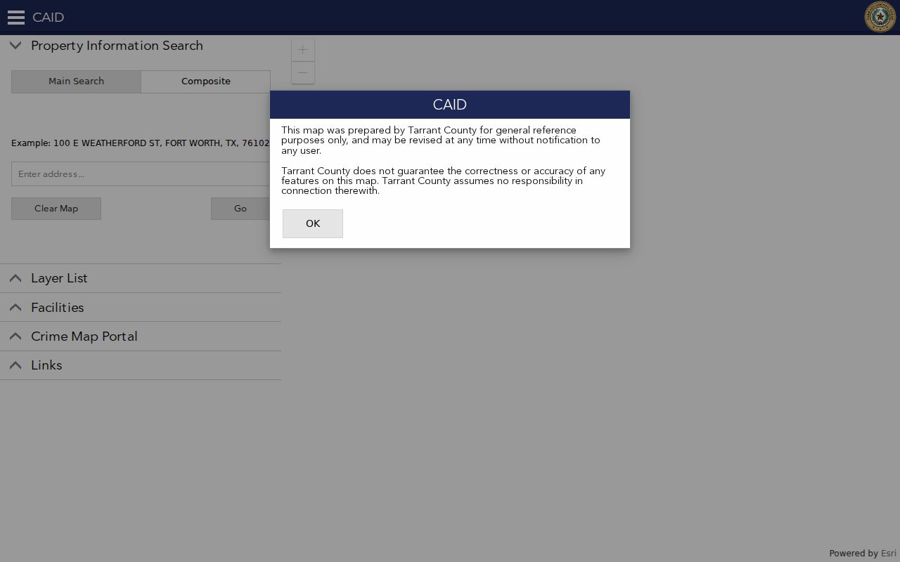
Use the Tarrant map as a county-level confirmation of a parcel route, then return to the official-record index for a recorded document.
Grand Prairie Historic Street Tools
Older street questions need sources that reflect their own period. UT Briscoe’s Grand Prairie telephone-directory sequence runs from 1918 through 2005 with gaps. Greater Dallas residence white pages also include Grand Prairie in a broader area for portions of 1957 through 2010, and the Library of Congress inventory has a specific 1966 Grand Prairie criss-cross entry. These are telephone, residence, or address directories, not a complete municipal roster.
For a block before modern parcel lines, the Library of Congress holds a nine-sheet Grand Prairie and Dalworth Sanborn set from 1929; UNT has a 1920 Grand Prairie sheet. A sheet can establish the presence of a building or use, not the name of its occupant. The Grand Prairie Texan has a 1938 to 1952 holdings gap, so a missing name in that period may reflect the collection rather than an absence. Compare adjacent-year papers, tax lists, and directories. The Grand Prairie city directories collection page is the narrower route for the historical shelf itself.
Note: Historic directories and maps are dated evidence, so pair them with a deed, tax list, or newspaper item before drawing a conclusion.
Limits of a Grand Prairie Street Directory
Grand Prairie has no universal citywide resident roster. GIS is people-adjacent, not people-identifying. A permit, code case, HOA listing, or map label also has a defined purpose and cannot be converted into a household list. The city’s voluntary HOA directory and map can help identify association or subdivision context, but a supplied association contact does not prove that person lives at an address. The same care applies to a deed, which records an instrument rather than present physical presence.
Texas voter information has separate protections for residence address, Social Security number, driver-license or personal-identification number, and designated protected-address categories. Use the Texas My Voter Portal only for its official status and polling-place function, and never publish protected result fields. When a result is uncertain, narrow the county and date or ask the named custodian about the applicable access rule.
Lawful personal use. Use Grand Prairie address and land records for a legitimate personal, family-history, estate, property, or civic question. Do not use any result to stalk, harass, threaten, impersonate, or contact a private person without a lawful reason.